The France scan begins in the north
UrbexScanner has started acquiring topology data and recent orthophotos for ten departments across northern France.
A new line on the map
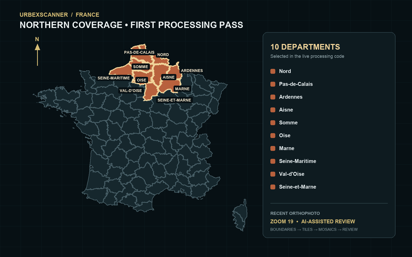
The France pipeline is moving from preparation into processing. UrbexScanner has started collecting department topology data and recent orthophoto tiles at zoom level 19 for a broad northern corridor: Nord, Pas-de-Calais, Ardennes, Aisne, Somme, Oise, Marne, Seine-Maritime, Val-d’Oise and Seine-et-Marne.
This first pass follows the Belgian research area across the border and into a remarkably varied landscape: old industrial belts, railway corridors, ports and river infrastructure, rural estates, institutional complexes and villages shaped by several eras of construction.
From a boundary to a candidate
The map above is not a decorative estimate. It is rendered from the same department boundaries and location list used by the live processing code. Those boundaries define the search area; imagery is then downloaded in small tiles, assembled into larger mosaics and prepared for AI-assisted review.
The model looks for visual signals worth a closer human look—unusual building forms, possible disuse, vegetation patterns, damaged roofs and distinctive industrial or heritage structures. It does not declare a place abandoned. AI creates leads; careful review supplies context.
A long scan, now underway
The initial plan spans roughly 24.1 million zoom-19 tile intersections, so this is deliberately a beginning rather than a finish line. Acquisition and mosaic construction will continue department by department before promising candidates enter the review dashboard.
As always, UrbexScanner publishes research progress rather than precise site coordinates. The aim is to understand the landscape responsibly, improve the detection method and reveal patterns that are easy to miss when viewing a region one image at a time.
The map has expanded. Now the patient work begins.